Four days of weather warnings for snow and ice as cold front sweeps UK
Yellow weather warnings for snow and ice have been issued, lasting four days as the UK is gripped by a spell of freezing weather.
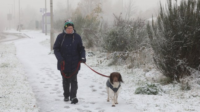
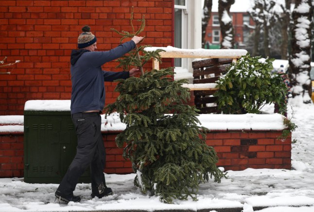
If you’ve been out of the door today yet, you’ll have noticed it’s chilly – and there’s colder to come, with Scotland and Northern England expected to see snow, and the whole od England warned of the potential for a ‘rise in deaths’ due to the weather.
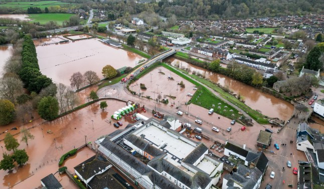
The ‘notable change’ comes after much of the UK and Ireland was battered with torrential rain and gusts by Storm Claudia, including unprecedented floods in Monmouth, where the high street was underwater.
Cold weather warnings have been issued by the UK Health Security Agency, with North West and North East England covered by an amber warning from today which will remain in place until 8am on Friday.
Sign up for all of the latest stories
Start your day informed with Metro’s News Updates newsletter or get Breaking News alerts the moment it happens.
The Midlands and areas south of this are all covered by a yellow cold health warning, with the potential for fatalities, specially in those aged over 65, or with health conditions.
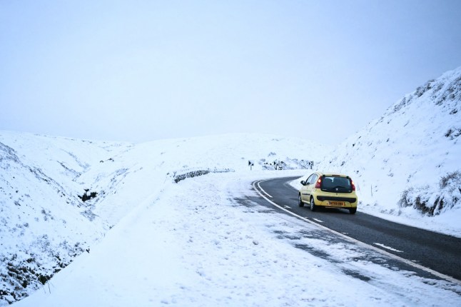
While prospects for building snowmen nationwide are unlikely, some areas will get such a dump it could block roads and cut off rural communities, and there could be disruption due to travel delays and power cuts, with icy roads also a concern.

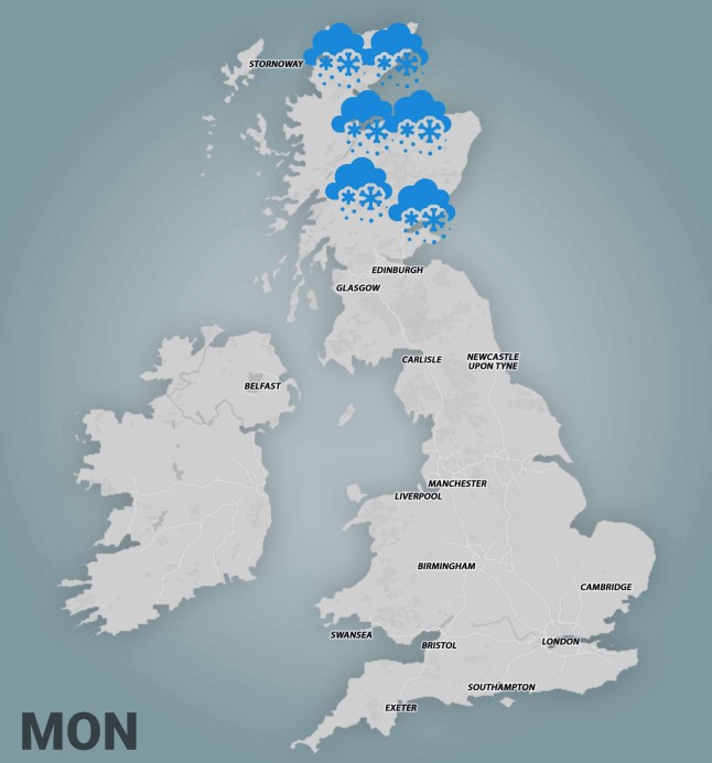
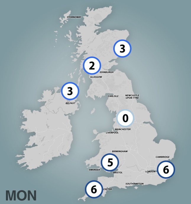
A Met Office snow warning for Wednesday and Thursday, covering North East England, the Scottish Borders and Yorkshire and the Humber, says: ‘Snow showers will feed inland from the North Sea, giving significant accumulations in places.
‘Where these are most frequent, 2-5 cm will be possible at low levels, with 5-10 cm on hills above 100 m elevation, and potentially as much as 15-20 cm above 300m.’
Some fairly strong gusts could be associated with the showers and some isolated lightning strikes are possible at times.
Where could see snow in the UK?
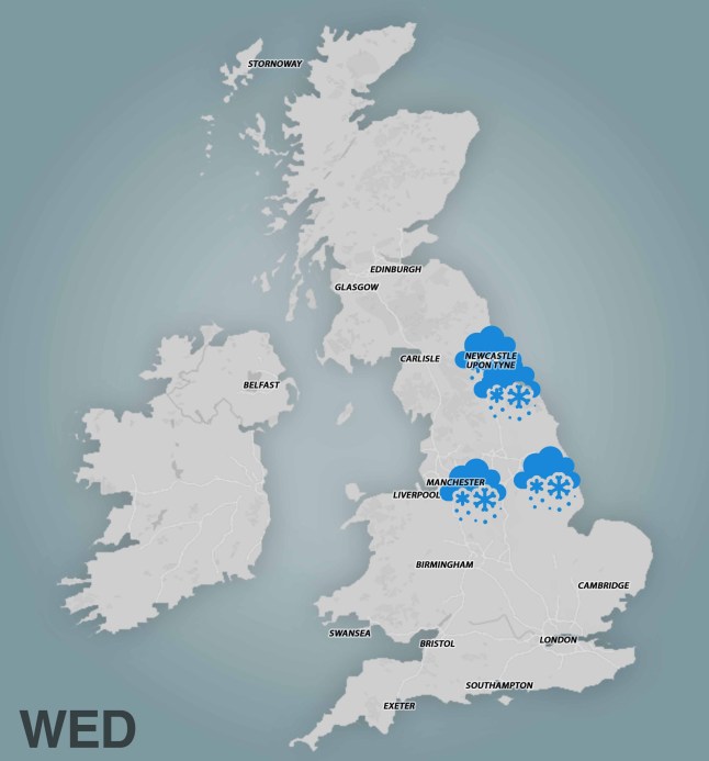
According to the latest Met Office weather map, Scotland will see most snow tomorrow evening and night, while on Wednesday there will be more of a dusting in northern England, including places like Newcastle-Upon-Tyne, Middlesbrough, and Hartlepool.
There are not currently any weather warnings in place, but the forecaster warned people to keep checking, as ‘it is possible warnings may be issued for snow and ice at times’.
A minimum temperature of -7°C was recorded on Saturday night in Tulloch Bridge, Scotland, marking the coldest night in the UK since March.
Why is it suddenly so much colder?
In other parts, warmer wetter conditions will be soon replaced by a ‘cold northerly flow’ from the Arctic, Met Office forecaster Dan Holley explained.
He said: ‘This will bring much colder conditions than of late and, whilst generally drier than recent days, there will also be a risk of wintry hazards, such as snow and ice.
‘There will be widespread frosts across the UK, with temperatures dipping as low as -7°C in places next week, and daytime temperatures staying in single figures across the country.
‘Couple this with a brisk northerly wind, and there will be a marked wind chill. This will be a notable change in our weather after a prolonged spell of above-average temperatures.’
What is a Cold health alert?
They are government warnings issued when cold temperatures are likely to have an impact on people’s health and wellbeing.
Issued by the UK Health Security Agency, they are influenced by Met Office forecasts and aim to give early warning to carers, health professionals, emergency services, government departments, and the population in general.
The core alerting season for cold runs from November 1 to March 31, while a summer alert system for heat runs from June 1 to September 30.
RAC Breakdown spokesperson Alice Simpson said: ‘There’s potential for freezing temperatures to make roads hit by heavy rain very slippery with a chance of ice.
‘We expect breakdown volumes to be around 10% higher than what’s normal for this time of year, which equates to around 1,000 more people needing our help each day.
‘Normal indicators of autumn, like fallen leaves on the road, can also become very hazardous in icy conditions as they create an extra layer between tyres and the road surface, increasing the likelihood of skidding.’
The cold snap comes after a major incident was declared in South Wales, where dozens of residents were evacuated from flooded homes.
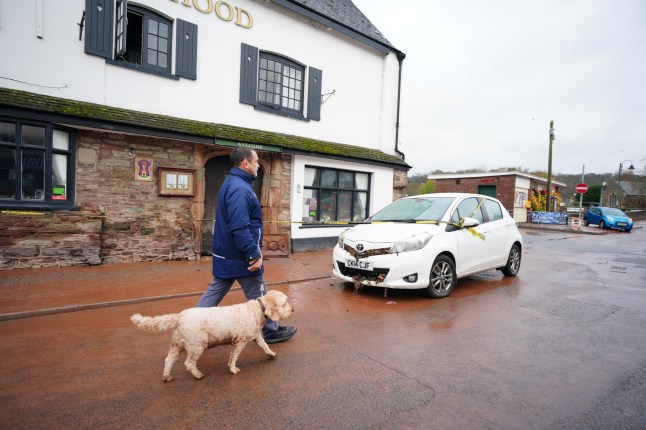
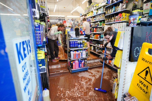
Significant rain brought disruption to businesses, transport and energy infrastructure.
Peter Fox, the Conservative Senedd member for the area, said the situation was ‘extremely bad’ and he hadn’t seen anything like it for decades.
‘I personally haven’t seen it so bad for probably 40 years, certainly in Monmouth since defences were put in place there’, he said.
Evacuated residents were supported by Red Cross volunteers at a local leisure centre.
In Monnow, river levels were higher than those reported following Storm Dennis in 2020 and Storm Bert last year.
Parts of England were also hit badly by the storm, with at least 20 homes flooded including in north as Cumbria, the Environment Agency reported.
Will we have a white Christmas this year?
Snow is great in November and all, but there’s only one date of the year people want the white stuff – Christmas.
Jim N R Dale, a senior meteorologist at the British Weather Services, told Metro that predicting a white Christmas is a ‘short bet’.
A five-day forecast is as accurate as a three-day one was four decades ago – a 10-day forecast can be a coin flip, let alone 37 days away.
‘The fact we are now about to enter a proper Arctic blast in my mind lifts the chances, given we tend to stay in certain patterns of weather for months on end,’ Dale said.
He warned, however, that high-pressure and warm southerly winds could dampen our chances.
‘Although good meteorological fortune on the day itself will be absolutely necessary, my thoughts are that the odds (though still against) are slightly shorter than recent years, even for London,’ Dale added.
‘My single flake work up to and on the day could well be tough going!’
What is a white Christmas?
The bar is actually very low for this – a weather official just needs to observe a single snowflake fall on December 25.
When was the last time we had one?
Even though no one woke up to a blanket of white snow outside, it was actually in 2023. About one in 10 Met Office weather stations recorded snowfall.
The last proper white Christmas we had was 2010, with forecasters saying it was ‘unusual’ given eight in 10 stations picked up snow.
Climate change – driven by planet-warming pollution caused by humans burning fossil fuels – has made white Christmases less likely in the past 20 years, Dale added.
Get in touch with our news team by emailing us at webnews@metro.co.uk.
For more stories like this, check our news page.